From gCaptain
The Bureau of Ocean Energy Management has released a 1.4 billion pixel map of the deepwater Gulf of Mexico that is up to 50 times more detailed than any map that has been pubicly released of the area.

The new Northern Gulf of Mexico deepwater bathymetry grid was created using 3D seismic surveys covering an area of 90,000 square miles and defines the precise water depth of 1.4 billion individual 40-by-40 ft. cells ranging from 130 to 11,087 feet (–40 to –3,379 m) deep.
To create the grid, BOEM says it was interpreted using over one-hundred 3D seismic surveys that were then mosaicked together into one incredibly-detailed downloadable map. “The grid provides enhanced resolution compared to existing public bathymetry maps over the region, delivering 10 to 50 times increased horizontal resolution of the salt mini-basin province, abyssal plain, Mississippi Fan, and the Florida Shelf/Escarpment,” BOEM says.
Not only does the map offer an enhanced visualization of the deepwater Gulf of Mexico as a whole, but also interesting seafloor features and geomorphological processes, like these ones noted below:
The full map(s) can be downloaded HERE.
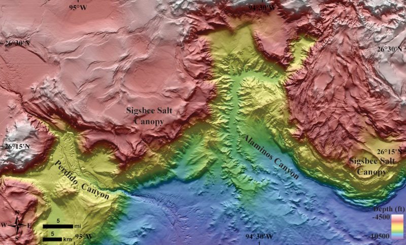
Alaminos and Perdido Canyons in new detail. The canyons funnel sediments to create an intermingling basin-floor fan system hundreds of meters thick.
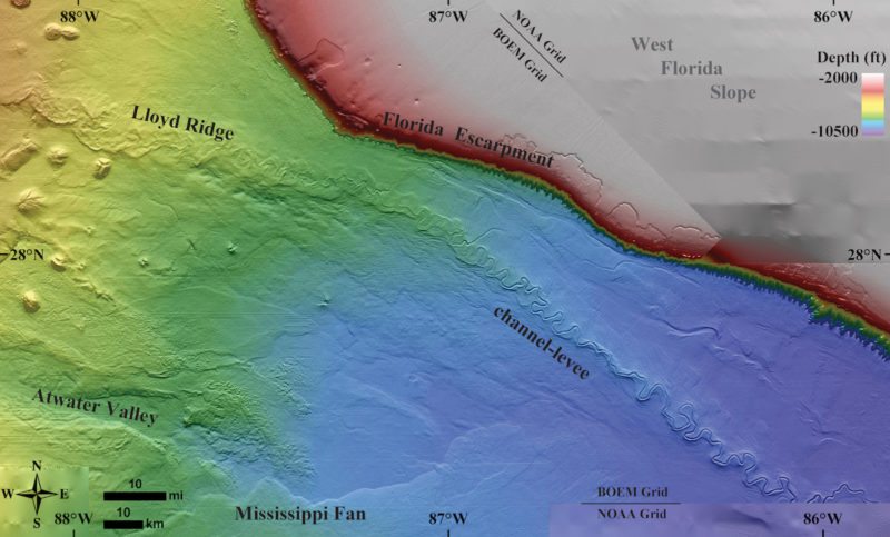
Lloyd Ridge is a relict, meandering channel-levee complex stretching 174 mi (280 km) on the eastern abyssal plain. An additional 150 mi (240 km) is fully buried beneath younger Pleistocene turbidite deposits and Holocene slope facies.

Features formed by the dynamic processes shaping the GOM, specifically salt movement and natural hydrocarbon seepage. This site is located in the southern end of the Terrebonne Basin within the Walker Ridge protraction. Thrust faulting and folding is due to southeast verging lateral movement of allochthonous salt. Movement of salt is what gives the Gulf of Mexico seafloor its rugose nature, also creating faults and fracture networks which provide pathways for oil and gas seeps.
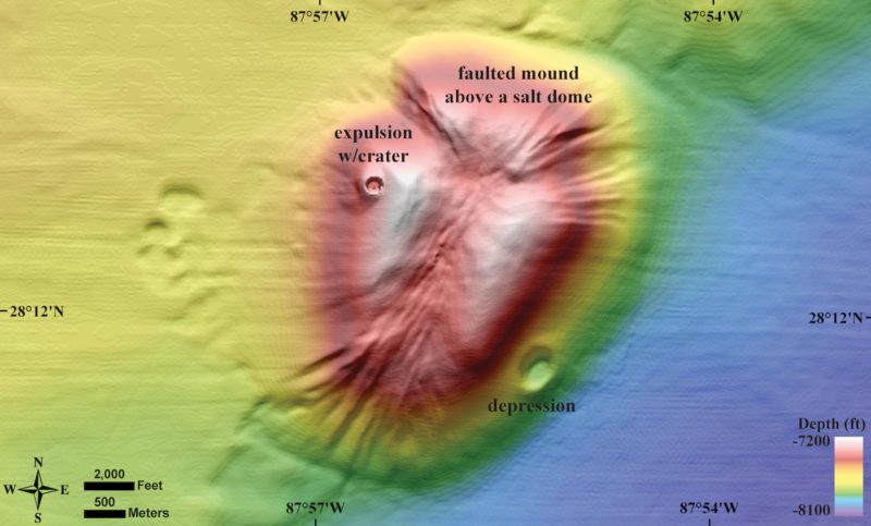
A seafloor landscape common to the GOM; a mound created from the interplay of basin subsidence and vertical migration of salt. As salt moves shallower relative to the subsiding basin around it, sediments are often uplifted and form seafloor mounds. Here, the movement created a network of extensional faults dividing the mound into three wedges.
All images courtesy BOEM.